
Snowfall is one of nature’s most fascinating yet unpredictable weather events. Among all forms of snow-related weather phenomena, lake effect snow is particularly unique. It can blanket a region in thick snow within a few hours while nearby towns remain almost untouched. For communities near the Great Lakes and other large inland water bodies, Lake Effect Snow Warnings are a regular part of winter life. These warnings are issued by the National Weather Service (NWS) to alert residents of impending heavy snowfall specifically generated by lake-driven weather systems.
This article provides an in-depth explanation of what a Lake Effect Snow Warning means, how lake effect snow develops, what factors contribute to it, and how individuals, communities, and businesses can prepare and respond effectively.
1. Understanding Lake Effect Snow
To comprehend a Lake Effect Snow Warning, one must first understand what lake effect snow is. It is a localized weather event that occurs when cold, dry air moves over a warmer lake surface. The relatively warm water transfers both heat and moisture to the air above it, making that air mass less stable. As the air rises and cools, the moisture condenses into snow clouds. When these clouds move over land, they release that moisture as snow — often in narrow but intense bands.
The process can produce extreme snowfall rates, sometimes exceeding 2–3 inches per hour, leading to rapid accumulations that can paralyze transportation and affect daily life.
Key Ingredients for Lake Effect Snow Formation
| Element | Description |
|---|---|
| Temperature Difference | At least 13°C (23°F) warmer lake surface compared to the air above |
| Wind Direction | Determines which areas downwind will receive snow |
| Fetch Length | The distance air travels across open water (longer fetch = more snow) |
| Atmospheric Instability | Cold air over warm water promotes vertical motion and cloud formation |
| Moisture Supply | Evaporation from the lake fuels snow production |
Each factor contributes to the severity and intensity of the snowfall, making forecasting a challenging yet crucial task for meteorologists.
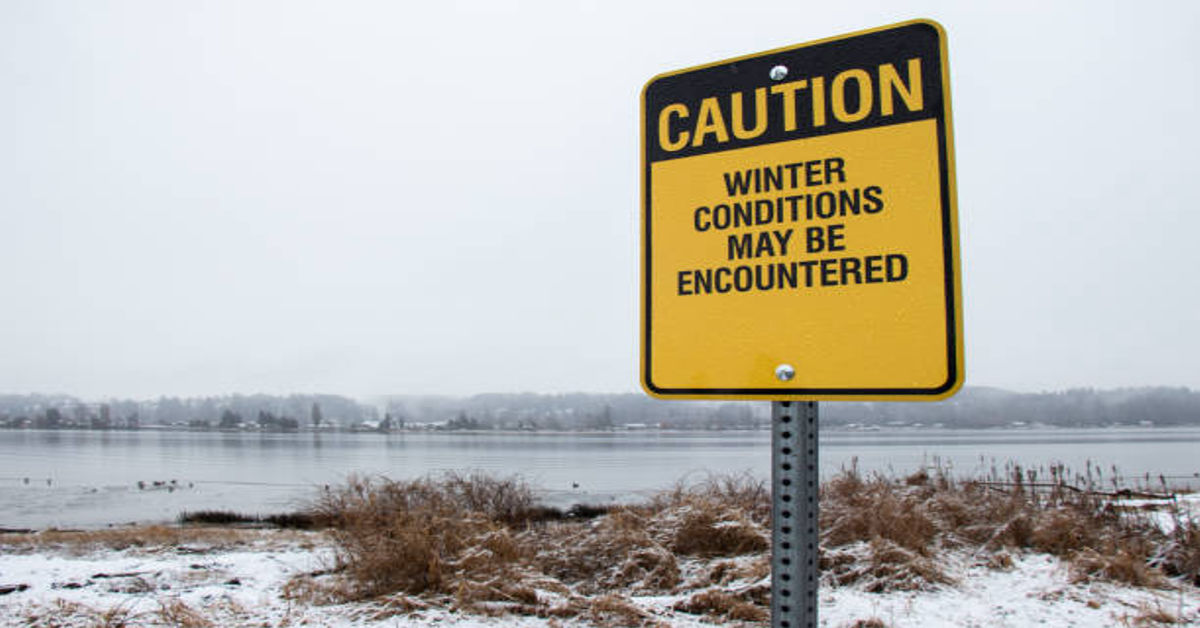
2. What Is a Lake Effect Snow Warning?
A Lake Effect Snow Warning is an official alert issued by the National Weather Service (NWS) when heavy snow from lake effect bands is expected to significantly impact an area within a short period of time. The warning typically implies hazardous travel conditions, poor visibility, and rapid snow accumulation.
Such warnings are often issued for locations near the Great Lakes, particularly around Lake Erie, Lake Ontario, Lake Michigan, Lake Superior, and Lake Huron.
Purpose of the Warning
The main purpose of a Lake Effect Snow Warning is to give residents and local authorities enough time to prepare for severe weather, reduce travel risks, and activate emergency response plans if needed.
3. The Science Behind Lake Effect Snow
Lake effect snow develops through a fascinating interplay of meteorological dynamics. It begins when cold Arctic air masses, typically originating from Canada, sweep across a warmer, unfrozen lake.
Here’s how the process unfolds:
- Cold Air Meets Warm Water: When frigid air passes over the lake, the water evaporates and warms the lower layers of the atmosphere.
- Heat and Moisture Transfer: The now-moist air becomes less dense and begins to rise.
- Condensation and Cloud Formation: As the moist air rises and cools, water vapor condenses into clouds.
- Snow Formation: These clouds grow vertically and form snow crystals.
- Snow Band Movement: Wind pushes the snow clouds inland, forming snow bands that drop intense snowfall over narrow regions.
Single-Band vs. Multi-Band Events
| Type | Description | Typical Impact |
|---|---|---|
| Single-Band Event | Occurs when steady winds align, producing one strong snow band | Heavy snow in narrow area; limited regional spread |
| Multi-Band Event | Caused by variable winds forming several smaller snow bands | Moderate snowfall over a wider region |
The difference between the two affects how communities experience snow intensity and duration.
4. When and Where Lake Effect Snow Occurs
Lake effect snow primarily occurs from late fall through early winter, when lakes are still unfrozen but the atmosphere above is significantly colder.
Common U.S. Regions Affected
| Lake | Primary Impact Areas |
|---|---|
| Lake Superior | Northern Wisconsin, Upper Michigan |
| Lake Michigan | Western Michigan, Northern Indiana, Chicago suburbs |
| Lake Huron | Eastern Michigan, parts of Ontario |
| Lake Erie | Western New York, Northwestern Pennsylvania, Northeastern Ohio |
| Lake Ontario | Central and Northern New York (including Tug Hill Plateau) |
The most intense events occur when cold northwesterly or westerly winds blow across the length of these lakes, carrying moisture that falls as snow downwind.
5. Differences Between a Lake Effect Snow Advisory, Watch, and Warning
To avoid confusion, the National Weather Service issues different types of alerts depending on the severity and timing of expected snowfall:
| Alert Type | Meaning | Public Action Recommended |
|---|---|---|
| Lake Effect Snow Advisory | Light to moderate snow possible; travel may be slightly affected | Stay updated; prepare for minor disruptions |
| Lake Effect Snow Watch | Conditions favorable for heavy snow but not yet certain | Monitor forecasts; review safety plans |
| Lake Effect Snow Warning | Heavy snow expected or occurring; major impacts likely | Avoid travel; follow emergency instructions |
A warning represents the highest level of concern, often signaling imminent or ongoing hazardous conditions.
6. Impacts of Lake Effect Snow Events
The impact of lake effect snow can be both immediate and long-lasting. While the localized nature of these events means some areas receive little snow, others nearby can experience near-blizzard conditions.
Major Impacts Include:
- Transportation Disruptions: Rapid snow accumulation leads to road closures, flight cancellations, and accidents.
- Power Outages: Heavy snow on trees and power lines can cause damage and blackouts.
- Emergency Response Delays: Roads may become impassable for ambulances or emergency vehicles.
- Economic Loss: Businesses face downtime, especially in logistics and travel sectors.
- School and Government Closures: Severe conditions may lead to temporary shutdowns.
Case Example
In November 2014, a major lake effect snowstorm hit Buffalo, New York, producing over 70 inches of snow in a few days. The event paralyzed entire communities and highlighted the power of lake-driven weather systems.
7. Safety Precautions During a Lake Effect Snow Warning
Safety should always be the top priority when a Lake Effect Snow Warning is issued. Here are comprehensive safety guidelines:
Before the Storm
- Stay Informed: Monitor local weather forecasts and alerts.
- Prepare Supplies: Keep an emergency kit with food, water, medications, and flashlights.
- Vehicle Readiness: Check tire pressure, antifreeze, and keep a snow shovel and blankets in your car.
- Home Preparation: Insulate pipes, stock up on heating fuel, and ensure proper ventilation for heaters.
During the Storm
- Avoid Travel: Stay indoors if possible; whiteout conditions can make driving extremely dangerous.
- Stay Visible: If you must drive, keep headlights on and follow plowed roads.
- Conserve Power: Unplug nonessential devices during power fluctuations.
- Stay Warm: Dress in layers and avoid prolonged exposure to cold.
After the Storm
- Clear Snow Safely: Use proper posture when shoveling to prevent strain.
- Check on Neighbors: Especially the elderly or those living alone.
- Inspect Roofs: Remove heavy snow accumulation to prevent collapse.
8. Emergency Kit Essentials for Lake Effect Snow Events
| Category | Items to Include |
|---|---|
| Food and Water | Bottled water, canned goods, manual can opener |
| Lighting | Flashlights, extra batteries, candles |
| Warmth | Blankets, gloves, hats, thermal clothing |
| Tools | Snow shovel, ice scraper, battery-powered radio |
| Health and Safety | First aid kit, medications, sanitizer |
| Vehicle Kit | Jumper cables, tire chains, emergency flares |
A well-stocked emergency kit ensures you’re prepared for potential isolation during severe snowstorms.
9. Forecasting and Tracking Lake Effect Snow
Forecasting lake effect snow is complex because of its localized and rapidly changing nature. Meteorologists rely on a combination of:
- Satellite imagery to monitor cloud formation.
- Doppler radar to detect narrow snow bands.
- Temperature and wind models to predict movement and intensity.
Because conditions can change quickly, forecasts are updated frequently, and warnings are refined as storms develop.
10. The Role of Local Authorities and Emergency Services
During Lake Effect Snow Warnings, local governments and emergency services coordinate response efforts, including:
- Deploying snowplows and salt trucks to keep major roads passable.
- Opening warming shelters for stranded individuals.
- Communicating through local media and alert systems.
- Assisting with search and rescue operations in extreme conditions.
Community cooperation and preparedness significantly reduce the impact of these storms.
11. How Climate Change May Affect Lake Effect Snow
The relationship between climate change and lake effect snow is complex. Warmer global temperatures can lead to warmer lake surfaces, which may initially increase snowfall because of more evaporation. However, over time, shorter winter seasons and earlier lake freeze could reduce the frequency of such events.
In the coming decades, scientists expect more intense but less frequent lake effect snowstorms, especially in the Great Lakes region.
12. Common Myths About Lake Effect Snow
| Myth | Reality |
|---|---|
| Lake effect snow happens only during blizzards | It can occur even under calm skies if conditions align |
| It affects entire states equally | It’s highly localized — sometimes just a few miles wide |
| Lakes must be completely ice-free | Partial open water areas are often enough to trigger snowfall |
| Wind direction doesn’t matter | Wind direction determines exactly where snow falls |
Understanding these facts helps the public interpret warnings more accurately and respond appropriately.
13. Long-Term Preparation for Lake Effect Regions
For residents living near large lakes, long-term readiness is essential.
- Invest in Snow Removal Equipment: Snowblowers and proper tools save time and reduce injury risk.
- Home Insulation: Well-insulated homes retain heat and prevent pipe freezing.
- Community Planning: Towns should maintain reliable snowplow fleets and emergency communication networks.
- Education and Drills: Local schools and businesses should practice snow emergency protocols annually.
Preparedness minimizes disruption and ensures community resilience.
14. Environmental and Economic Effects
While lake effect snow is often disruptive, it also plays a role in maintaining ecological balance. The moisture it brings replenishes groundwater and supports vegetation in spring.
Economically, though, the effects are mixed. While tourism industries (like skiing) may benefit, transportation and retail sectors often face significant losses during prolonged snow events.
15. Conclusion
A Lake Effect Snow Warning represents one of the most serious winter weather alerts in cold regions, especially around the Great Lakes. It signifies not just the arrival of snow, but the potential for extreme, localized, and rapidly changing conditions that can disrupt every aspect of daily life.
Understanding the science, impacts, and necessary precautions associated with lake effect snow allows individuals and communities to stay safe, prepared, and resilient. Whether it’s stocking up on supplies, monitoring forecasts, or avoiding unnecessary travel, proactive steps save lives during severe winter weather.
By respecting these warnings and learning how to respond effectively, we transform potential disasters into manageable challenges — turning awareness into safety and preparation into peace of mind.
FAQs about Lake Effect Snow Warning
1. What is a Lake Effect Snow Warning?
A Lake Effect Snow Warning is issued by the National Weather Service when heavy, localized snowfall is expected due to cold air moving over a warm lake, creating hazardous travel conditions.
2. How long does lake effect snow usually last?
It can last anywhere from a few hours to several days, depending on wind patterns, temperature, and lake conditions.
3. Which areas are most affected by lake effect snow?
Regions downwind of the Great Lakes—especially parts of Michigan, New York, Ohio, and Pennsylvania—experience it most frequently.
4. How can I stay safe during a Lake Effect Snow Warning?
Avoid unnecessary travel, keep emergency supplies ready, and stay updated with official weather alerts until the storm subsides.
5. Does lake effect snow contribute to total seasonal snowfall?
Yes. In some areas near the Great Lakes, lake effect snow can account for 50–70% of total winter snowfall annually.